How to Use Old Maps
Introduction
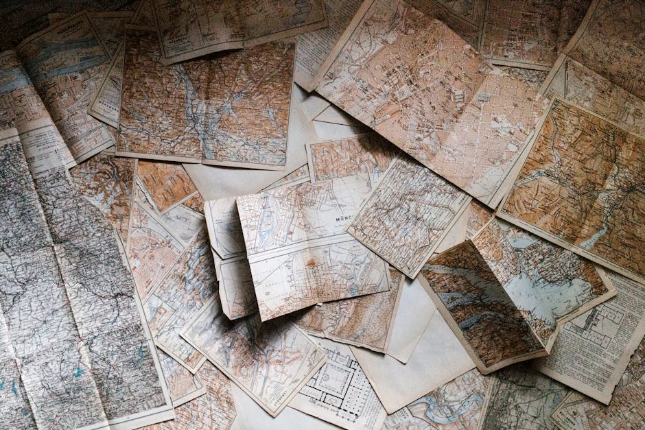
Old maps, more than just relics of the past, are windows into bygone eras. They offer insights into history, geography, and even genealogy. But beyond their historical value, old maps can be surprisingly useful in modern times. This article explores creative and practical ways to breathe new life into these fascinating artifacts.
Understanding Your Old Map
Deciphering Map Symbols and Legends
Before putting your old map to use, take the time to understand its language. Key elements include:
- Scale: Determines the relationship between distances on the map and actual distances on the ground.
- Legend: Explains the symbols used to represent different features like roads, buildings, and geographical formations.
- Orientation: Shows which direction is north. Some older maps may not have north at the top.
- Date: Crucial for understanding the map’s historical context and accuracy.
Assessing the Map’s Condition
Handle old maps with care. Before using them, consider their condition:
- Fragility: Is the paper brittle or torn?
- Discoloration: Has the paper yellowed or faded?
- Damage: Are there stains, water damage, or insect damage?
If the map is fragile, consider having it professionally conserved before use. Digitizing the map is always a great way to preserve it.
Practical Uses for Old Maps
Genealogical Research
Old maps can be invaluable for tracing family history. They can help you:
- Locate Ancestral Homes: Find the locations of villages, farms, or even individual houses that no longer exist or have changed names.
- Understand Migration Patterns: Track the movement of your ancestors based on road and settlement patterns depicted on the map.
- Identify Historical Context: Gain insight into the social and economic conditions in which your ancestors lived by understanding the historical geography of their region.
Land Ownership and Property Research
Old maps, especially plat maps, can provide critical information for property research:
- Determine Historical Boundaries: Trace the evolution of property lines and identify changes over time.
- Research Easements and Rights-of-Way: Uncover historical easements or rights-of-way that may affect your property.
- Identify Old Structures: Discover the locations of former buildings or structures that may have existed on the land.
Hiking and Outdoor Exploration
While GPS technology is ubiquitous, old maps can offer a unique perspective for outdoor adventures:
- Discover Forgotten Trails: Identify old footpaths, logging roads, or abandoned routes that are not marked on modern maps.
- Understand Topography: Study contour lines and elevation changes to plan challenging hikes or identify potential hazards.
- Connect with History: Explore the landscape with a sense of historical context, imagining how the area was used and perceived in the past.
Creative and Decorative Uses for Old Maps
Wall Art and Home Decor
Old maps can be transformed into stunning pieces of art:
- Framed Prints: Frame the entire map or a section of particular interest.
- Wallpaper: Use digitized maps to create custom wallpaper for a unique and historical touch.
- Decoupage: Apply map fragments to furniture, boxes, or other decorative objects.
Craft Projects and Gifts
Old maps offer a wide range of craft possibilities:
- Map-Covered Journals: Cover notebooks or journals with map segments for a personalized touch.
- Map Coasters: Create unique coasters by sealing map pieces under resin or glass.
- Personalized Gifts: Incorporate maps of meaningful locations into custom gifts for friends and family.
Protecting and Preserving Your Old Maps
Proper Storage Techniques
Preserve your maps for future generations by:
- Flat Storage: Store maps flat in acid-free folders or archival boxes to prevent creases and folds.
- Climate Control: Maintain a stable temperature and humidity to prevent paper deterioration.
- Light Protection: Keep maps away from direct sunlight or bright artificial light to avoid fading.
Digitization for Preservation and Access
Digitizing your old maps can help preserve them and make them more accessible:
- Scanning: Scan the map at a high resolution to capture all the details.
- Digital Archiving: Store the digital image on a secure and reliable storage device.
- Sharing and Research: Share the digitized map online with researchers, family members, or historical societies.
Conclusion
Old maps offer a wealth of information and creative possibilities. Whether you’re using them for genealogical research, outdoor exploration, or home decor, understanding their historical context and proper handling techniques is essential. By preserving and appreciating these valuable artifacts, we can connect with the past and gain a deeper understanding of our world.


Post Comment